Karsten Lehmann 14 October 2026 09:00:00
There is a new app in the Haven App Store, and its feature list reads a little odd at first. Mindoo Cairn keeps a municipal tree inventory with inspection intervals and four-eyes approvals. It also runs the situation map of a relief team in a flooded valley. And on Saturday afternoon it sends a school class through the old town on a scavenger hunt with a manga intro, a balloon-popping mini game and a fanfare at the finish.
Tree inspections, disaster relief and treasure hunts are not an obvious family. What they share is the thing in the middle of the screen: a map that several people look at, draw on and argue about - often in places where the network is somewhere between bad and gone.
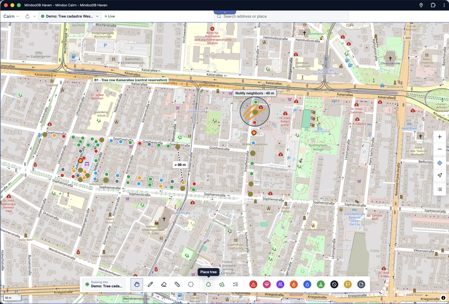
Why “Cairn”?
A cairn is a small pile of stones that people stack by hand to mark a place - a path across a scree field, a summit, a ford, a spot worth remembering. You find them in the Scottish highlands, on Icelandic lava plains and along alpine trails, and they work without batteries, signal or a map legend: anyone who passes can read them, and by custom many hikers add a stone of their own on the way through.
That is more or less the idea of the app. A shared mark in the landscape that keeps telling the next person what the last one found, that works where there is no network, and that grows a little every time someone comes by. The app icon is exactly that: three stacked stones with a map pin on top.
A map first
That is honestly how it started. The goal was not a tree inventory or a crisis tool. It was a practical, good-looking map app on which a team can mark and sketch together, that works offline, and that keeps its data private - the kind of app MindooDB was built to carry.
So the foundations came first:
- The map. OpenStreetMap tiles, sharp vector maps, a 3D view with buildings that you tilt and rotate with two fingers, address search, and a tap on any shop, school or hydrant shows what OpenStreetMap knows about it.
- Drawing. Pins with photos, scans and Markdown notes; freehand sketches with a pen, a finger or the mouse; lines, areas and distance measurements. Each of these is its own MindooDB document, so when two people draw at the same time their work merges as new objects instead of fighting over one shared drawing - and the titles and notes are saved as text patches that Automerge combines character by character.
- Offline. Map areas can be stored on the device ahead of time, and every device holds its own copy of the workbooks. You work at full speed in a cellar, in a forest or in a valley without a mast, and changes merge on the next sync - through the server, or directly between two devices when there is no server within reach.
- Phone, tablet, desktop. The same app in the field, in the vehicle and in the office, and thanks to sync they all show the same map.
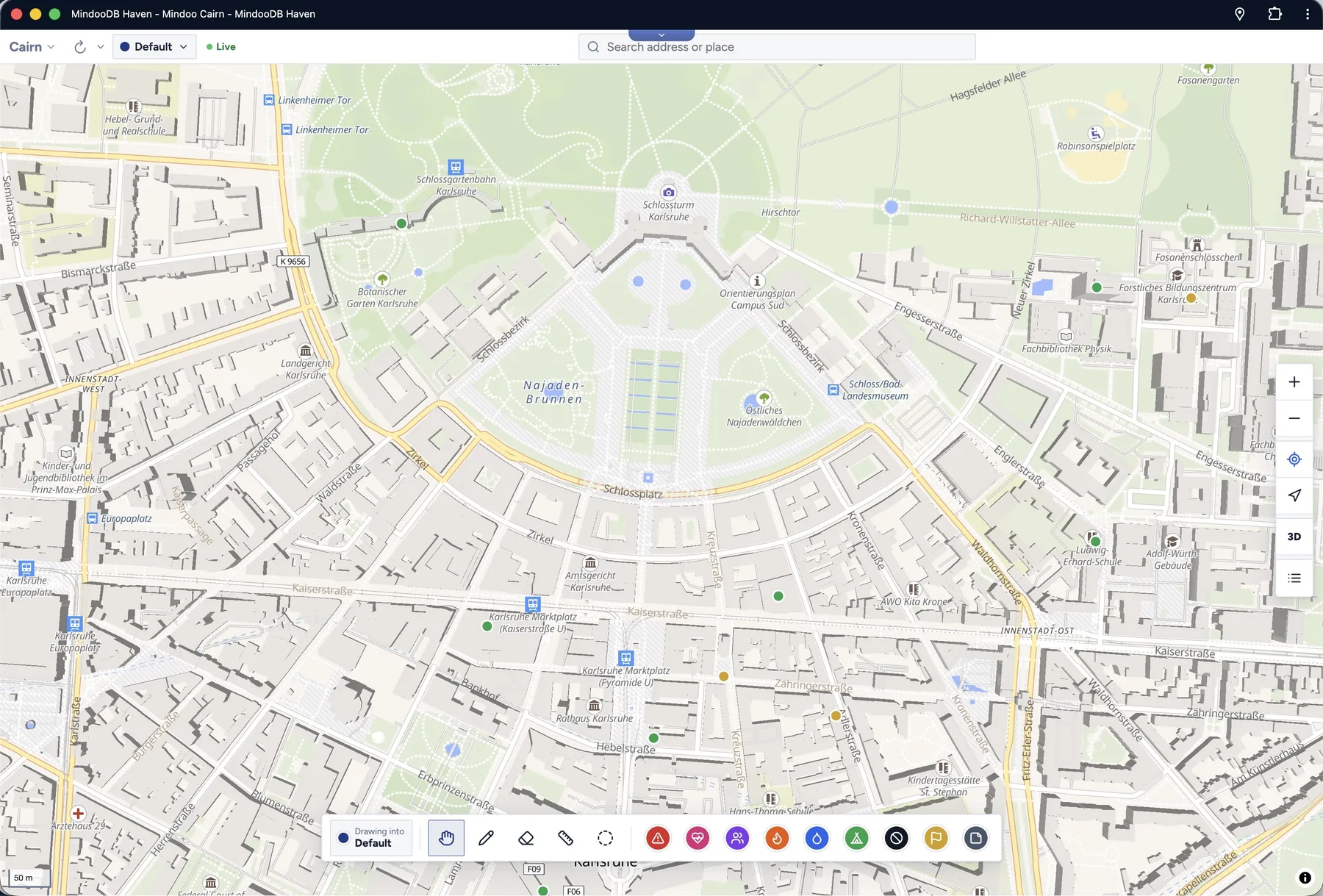
Workbooks: one map, many jobs
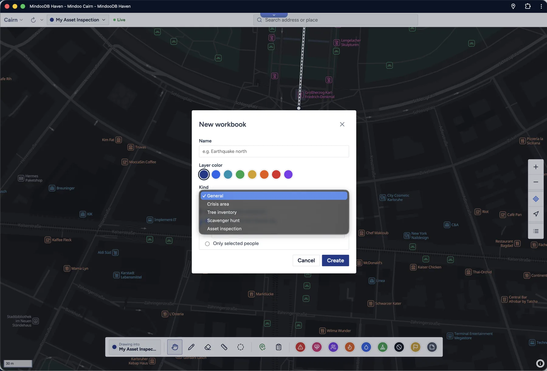
Everything you put on the map lives in a workbook - a layer with its own purpose, colour and readers. You can open several at once, close the ones you do not need on this device, and move objects between them.
When you create a workbook you pick its kind, and that is where Cairn stops being a general map and becomes a tool for a particular job.
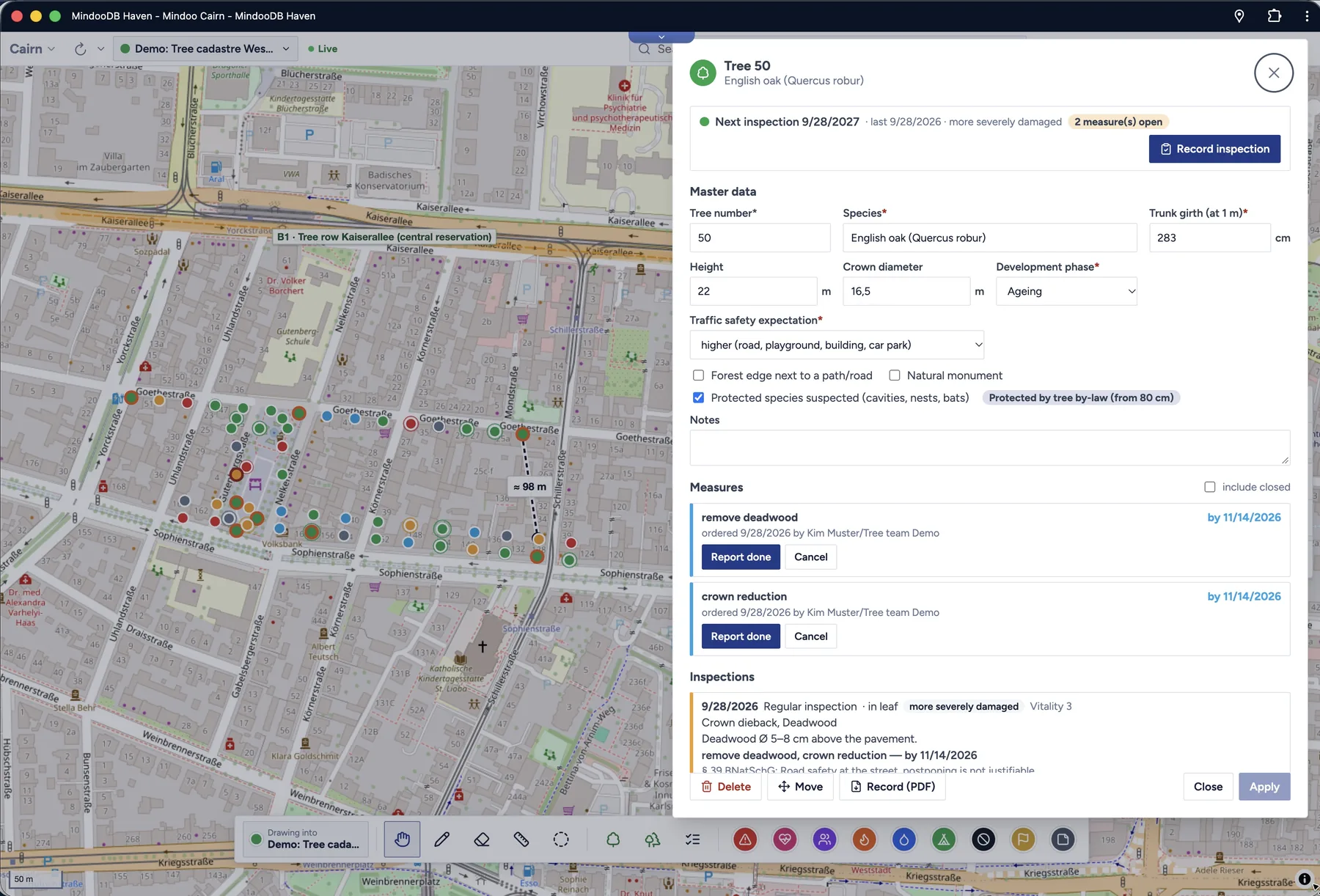
Tree inventory. Trees and whole stands after the German FLL guideline: master data, the next inspection date, defects found, open measures. The map colours every tree by its status, the tree list filters by due, overdue and never inspected, and measures go from open to done to approved - in professional mode with a second pair of eyes. Inspection records with photos and tree lists come out as PDF. It works for a city’s green-space department and just as well for a private owner with forty trees along a driveway.
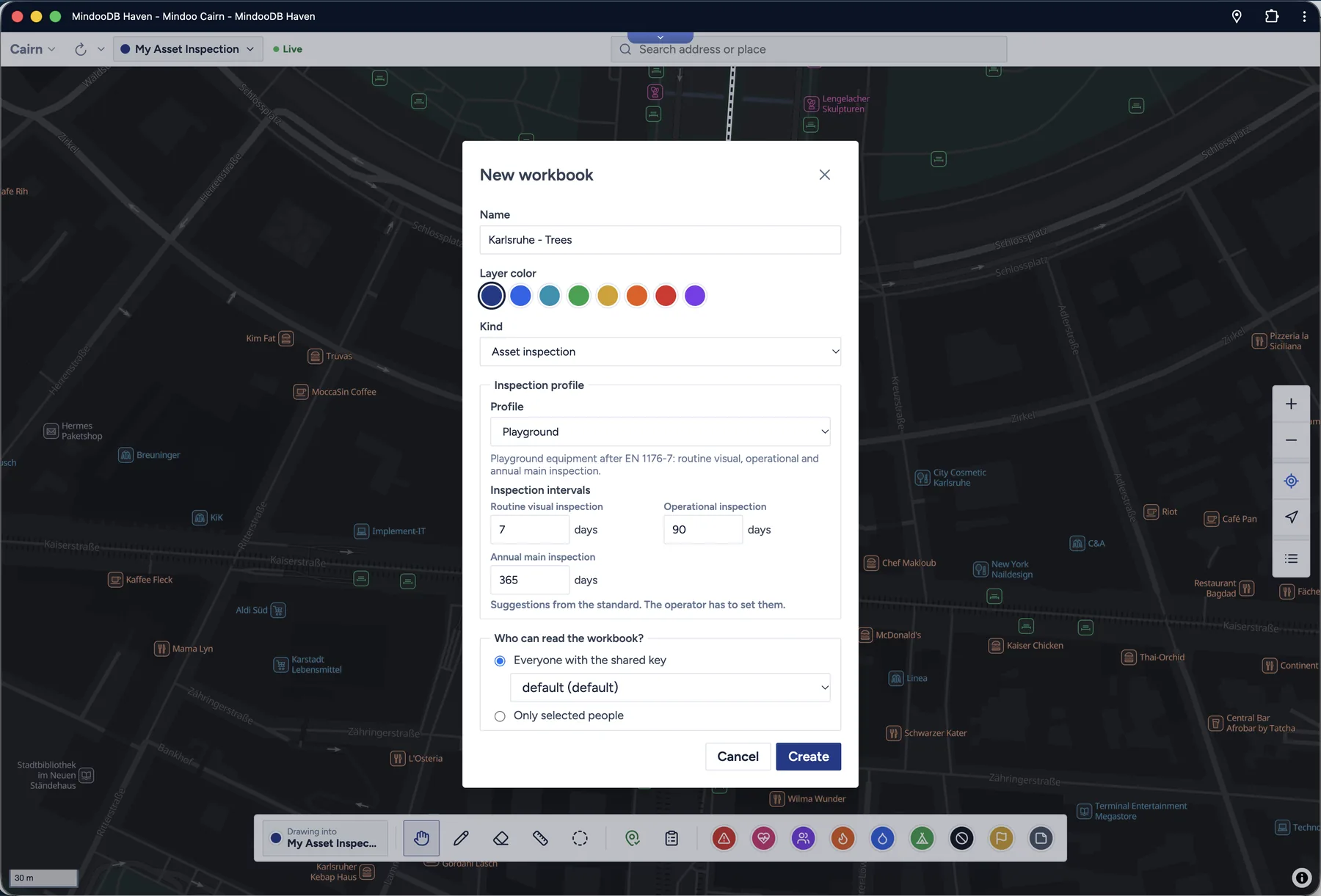
Crisis situation. Tactical symbols with status, count and triage category; exclusion, danger, work and flood areas; an incident log, orders, and a situation report as PDF. This is where peer-to-peer sync stops being a technical detail. A relief team in a region without infrastructure keeps mapping, and when two vehicles stand next to each other in the evening, their devices exchange what each of them saw during the day.
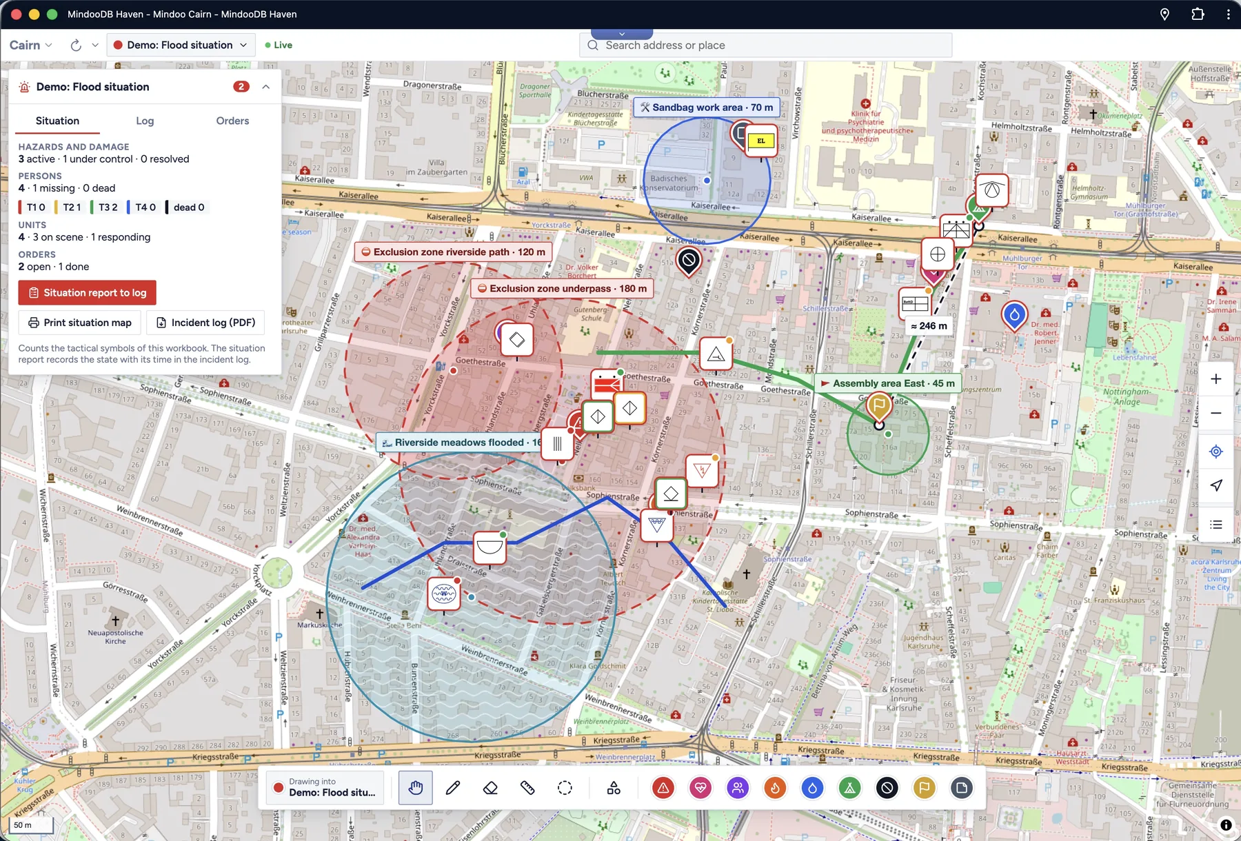
Asset inspection. Playground equipment after EN 1176-7, fire hydrants, nest boxes - anything that stands somewhere and has to be checked on a schedule. Each profile brings its checklist and intervals, findings turn into measures, records come out as PDF, and QR labels mark every object on site.
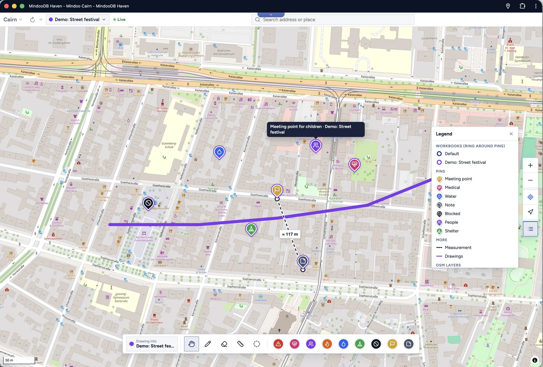
Event planning needs no kind of its own - a general workbook is enough. Meeting points, stands, first aid, the parade route and the closed streets, a legend for every layer, and a wall-sized poster print for the briefing. On the day, every helper has the same picture on their phone.
And then, a game
Scavenger hunts are the kind that started as a joke and ended up with more engineering in it than any of the others.
You plan the stations on the map - a riddle, a photo, a location code - test the whole route, and then publish it as a separate, encrypted game workbook. A clue is only readable at the right place: the key to the next station is derived from where it is and the code you find there, so nobody can read ahead by looking at the data. Stations can hold mini games that use the camera, the microphone or the motion sensors, teams can be required to put their shared secret together, and there is a ranking, a comic intro and a finale with fanfare.
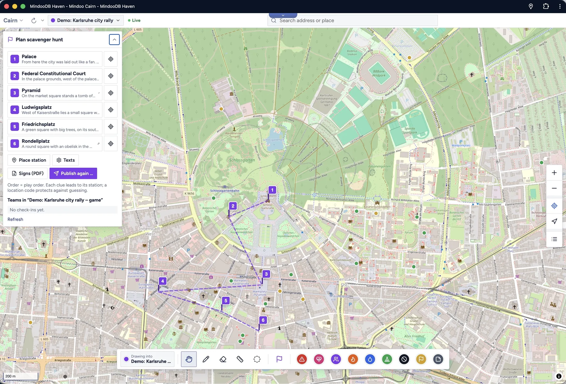
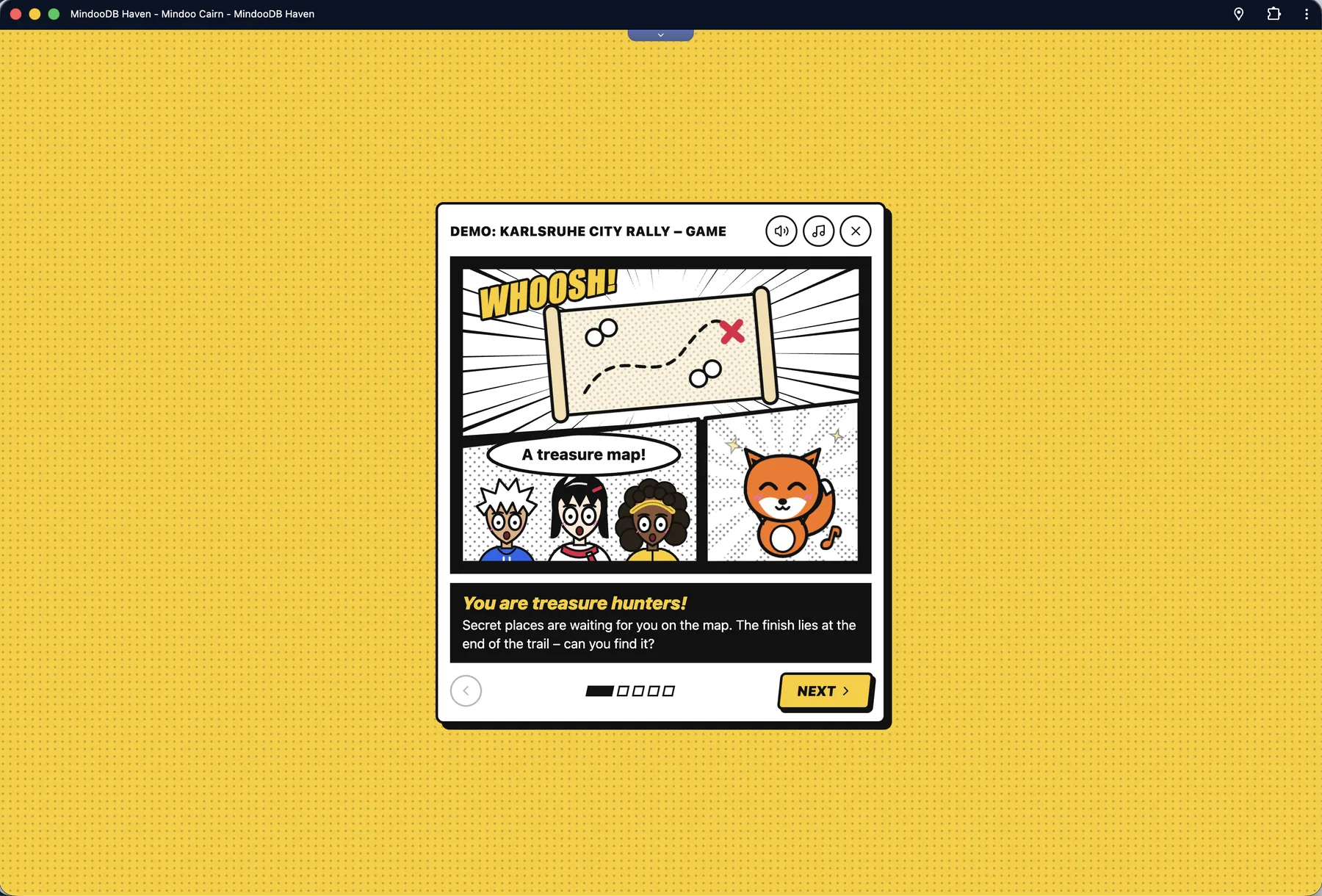
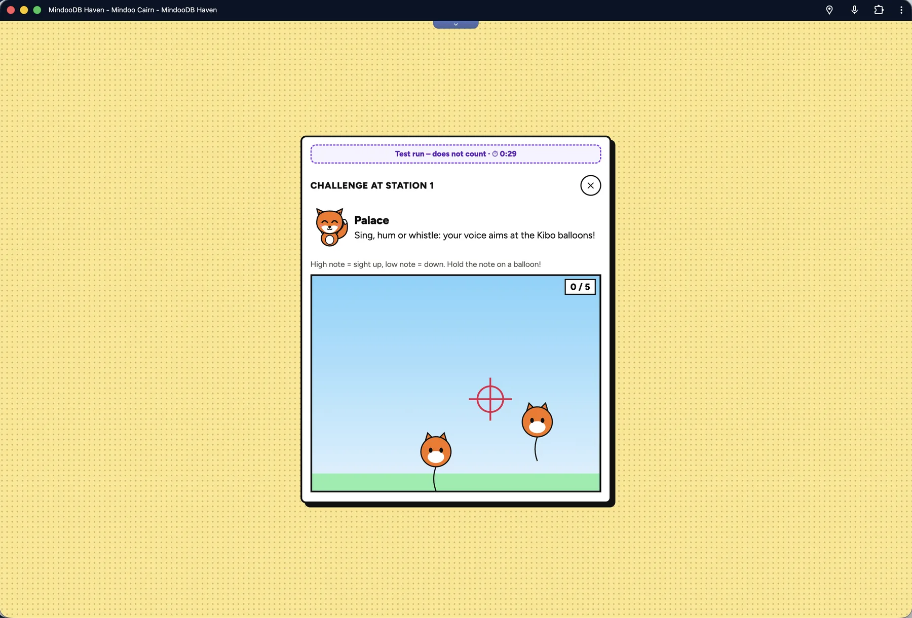
Is that serious software? Not really. But it exercises the same map, the same sync and the same encryption as the tree inventory - and it is a lot more fun to test.
Comparing then and now
MindooDB stores every change append-only; nothing is overwritten. For Cairn that means time travel: open a workbook as it was on any earlier date and compare it with another point in time, either side by side or with a slider you drag across the map. How far did the flood area grow overnight? Which trees were inspected in the spring round? What did the plan for the street festival look like before the fire brigade’s comments? Every change is still there, with its author and its time.
Who can read it
As everywhere in Haven, content is encrypted on the device before it is stored or sent, and the server - including ours, when it is ours - keeps ciphertext. When you create a workbook you decide who may decrypt it: everyone who holds a shared key, which suits a department or an event crew, or a list of named people, which suits a sensitive situation map or a private property. That covers the pins, the notes, the photos and the drawings.
Work in progress: a map an AI can draw on
There is another scenario we have in mind, and it is the reason the feature list above is probably not the final one.
We are currently making the whole Haven platform operable by AI through WebMCP, a proposed web standard with which a page offers tools to an AI agent in the browser - with names, descriptions and input schemas - instead of the agent guessing its way through buttons and screenshots. Haven exposes its own tools (list and open apps, list tenants, navigate, start a sync and check on it), and every app can register tools of its own through the App SDK. The user switches this on per app, and the agent sees only what that app offers.
Cairn is one of the apps that already does. Its tools, all prefixed cairn_, let a model:
- find out what the user is looking at - the visible area, the GPS position, the open workbooks (
cairn_get_context), - search markers by area, category, time span, author or full text, across open and closed workbooks (
cairn_search_markers,cairn_marker_get), - put pins and areas on the map, edit and delete them, each as one step in the undo history (
cairn_create_marker,cairn_create_exclusion_zone,cairn_update_marker,cairn_undo), - move the map to what it is talking about (
cairn_show_on_map), or render a part of the map as an image together with a description in words for models that cannot see (cairn_map_render), - summarise everything entered in an area and time span, as the basis of a situation report (
cairn_area_report), - and, for the tree inventory, look up trees, record inspections and update measures.
The interesting part is what happens across apps. A pin an agent creates can carry a hidden origin - the app and record it came from - so the same customer, task or incident is never placed twice. That turns Cairn into a place where a model can visualise data that lives somewhere else: “put the addresses from these open tasks on the map”, or “show me the customers I am visiting next week in a new workbook”. The model reads in one app and draws in the other; you watch it happen and can undo it with one click.
This is genuinely work in progress - the WebMCP standard itself is still moving, and so are our tool sets. But it already runs, and it changes how you think about what a map app is for.
Trying it
Cairn is a one-click install from the Haven App Store: pick the tenant that should hold your workbooks and it opens ready to use. Under Settings → Demo data it creates sample workbooks with realistic, fictitious content - a tree inventory along real streets in Karlsruhe, a flood situation and a street festival - so you can try them without typing in a single tree. Each one is called “Demo: …” and goes away again with one click. It speaks German, English, Spanish, French, Italian, Norwegian, Dutch and Polish.
The full tour - with a globe you can spin - is on the new site at mindoo-cairn.com. Cairn runs on Haven; MindooDB Cloud is the managed sync layer that keeps your encrypted workbooks in step across devices and covers every Haven app, at €7.99 per user per month or €79.99 per year - the details are on the pricing page.
Haven Community remains free to use for private and commercial projects at haven.mindoodb.com. MindooDB itself is open source under the Apache 2.0 licence, and everything else is at mindoodb.com.